


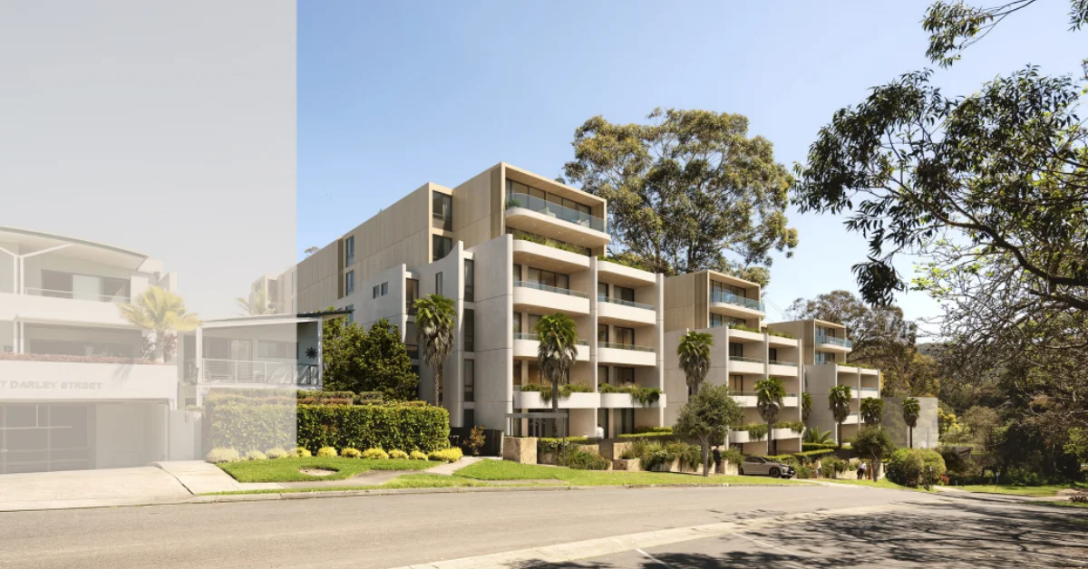
An 82-apartment residential development has been proposed in Mona Vale, with a State Significant Development application lodged for land on Darley Street West near Bayview Golf Course.
A Major In-Fill Proposal In Mona Vale
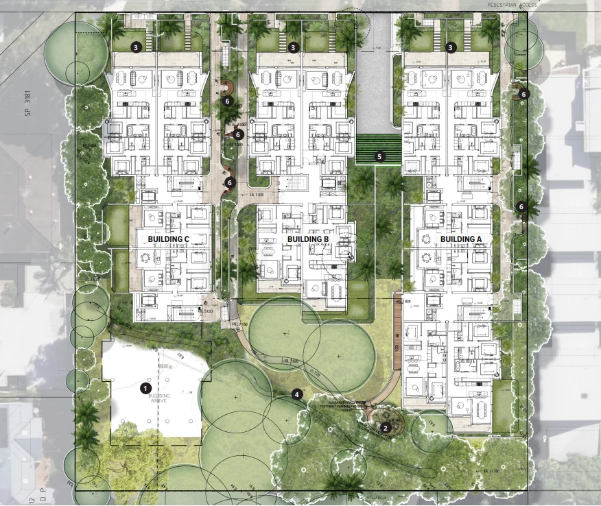
The proposal applies to 159–167 Darley Street West, covering a 6,122 square metre site opposite Bayview Golf Course and just under 800 metres from the town centre. The development comprises three apartment buildings and is listed under State Significant Development reference SSD-91496958.
Public exhibition materials were issued in January 2026, with the project now recorded on the planning portal at the collation of submissions stage.
Design, Height And Key Planning Metrics
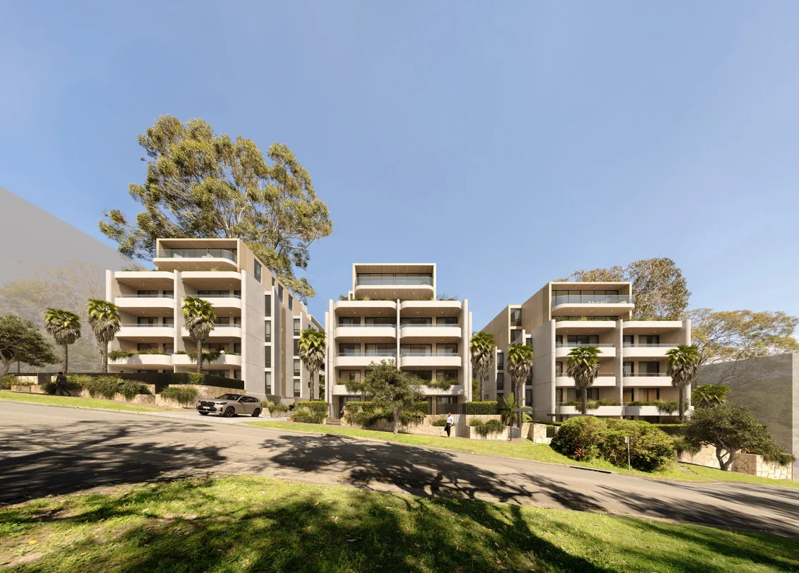
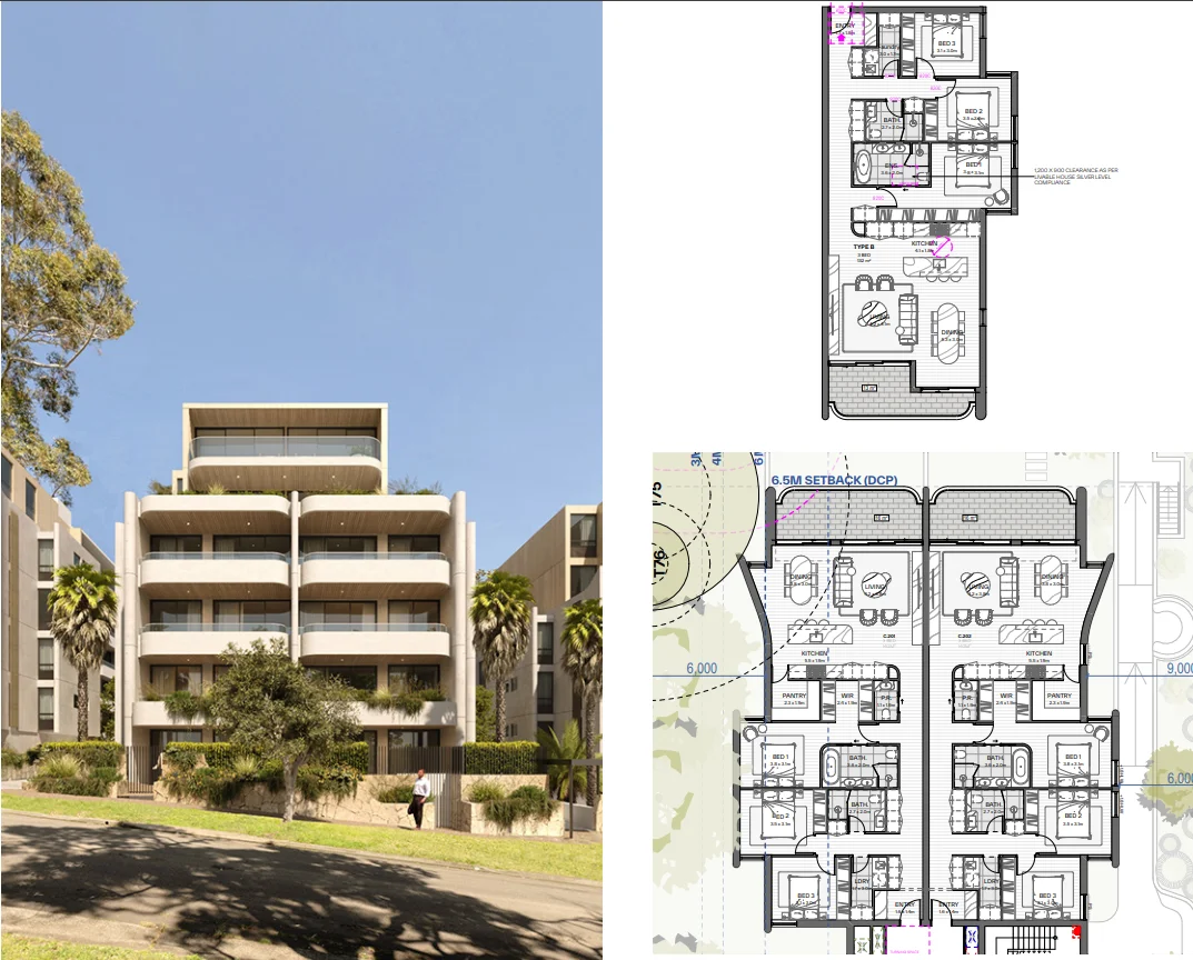
Plans prepared by PBD Architects propose three buildings rising to a maximum of six storeys, reaching a height of 21.175 metres. The gross floor area is 10,928 square metres, with a floor space ratio of 1.8:1.
The design uses stepped building forms, setbacks, and landscaped separation between structures to manage scale and respond to the site’s slope, solar orientation, and surrounding development pattern.
Environmental Constraints And Landscape Strategy
The southern portion of the site contains an overland flow path and remnant native vegetation, requiring flood and biodiversity considerations to be addressed during assessment. One building is designed to span the flow path on columns to maintain natural drainage, while another is set back to reduce impacts on retained vegetation.
The proposal includes the removal of 58 trees, including exempt species, with 84 native trees proposed for planting as part of the landscape strategy. Deep soil zones account for 38 per cent of the site, and a rear bushwalk is proposed to provide shared open space and maintain a connection to the surrounding landscape.
Parking, Access And Transport Context
Vehicle access is proposed from Darley Street West, with three basement levels providing 164 car spaces, as well as bicycle and motorcycle parking. No footpath currently exists along the site frontage.
The location is within 300 metres of a local bus stop and less than one kilometre from the B-line express service corridor.
Planning Controls And Assessment Pathway
The land was rezoned in April 2025 from low-density to medium-density residential under the Pittwater LEP 2014, introducing a five per cent affordable housing requirement. A dwelling density limit applying to the site was removed in September 2025, enabling the proposal to fully utilise planning controls under the low and mid-rise housing framework.
The application remains under assessment, with further steps to follow after submissions are reviewed.
Published 3-Feb-2026


